We’re certainly not in Kansas, but we may be more prone to tornadoes than you realise
By Andy Swales
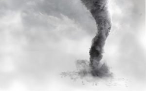
When we think of tornadoes, our minds tend to turn to dramatic images from the United States – vast columns of wind-whipped dust and debris spinning across the plains, tearing up everything in their path.
But Australia is not immune to the fearsome phenomenon, and the Bureau of Meteorology recently warned that “live fast and die young” winter tornadoes, born of cold fronts, pose a greater threat here than most people realise.
In fact, southwest Western Australia is “one of the more tornado-prone regions in the world”.
The bureau says cold weather tornadoes “differ from US tornadoes, which can last for hours and travel hundreds of kilometres, usually during the warmer months.
“Our cool-season tornadoes form and collapse in the space of about 10 to 30 minutes. But in that short time, they can still create plenty of damage.”
These “coldies” move across the ground at 50-80km/h and create narrow paths of damage up to several kilometres long.

The bureau says the impacts can be “devastating”, leading to millions of dollars of insurance losses, and it gives some recent examples.
In May 2024, a tornado developed within a severe thunderstorm over Bunbury in WA and damaged more than 200 properties; in July 2010, Penola in southeast South Australia suffered damage to more than 40 buildings in only one minute; in May 2005, insured losses of $50 million were recorded in the Perth suburb of Bicton; and in September 1993, a tornado destroyed eight houses and damaged 100 in Mandurah, WA.
A James Cook University Cyclone Testing Station report on the Bunbury storm noted debris propelled on gusts of 160km/h included “branches from trees, loose items around yards including trampolines and rubbish bins, lightweight car ports and patio roofs, and building components including roofing and solar panels”.
One South Bunbury resident, Luke Clark, told the ABC at the time: “You see the cold fronts and you know there is going to be rain, but just the force of [the storm], and obviously the damage that it’s caused … it was a bit surprising.”
The bureau says its forecasters can identify “broad areas” where cool season tornadoes may form, but it is hard to be more specific. “This is because they’re so short-lived and localised. They can even be difficult to identify on radar, due to their small size.”
It says three key ingredients go into making a coldie: low-level wind shear – when wind speed or direction changes between the ground and about one kilometre altitude; unstable air rising to form tall storm clouds; and a lifting mechanism, usually a cold front, to start cloud development.
Anthony Cornelius, a meteorologist and the MD of Weatherwatch, tells Insurance News coldies occur when “wind shear is very strong but instability, while present, is not as strong.
“As wind shear remains the primary ingredient of a tornado, you can consider that wind shear can ‘compensate’ for the weaker levels of instability in some cases.
“They tend to be short-lived and smaller than the resolution of … radar, which makes them much harder to warn for (they might last only a few minutes).
“The coastal areas of southwest WA are certainly a hotspot for cold season tornadoes, but they can also occur in Victoria and most likely occur over western Tasmania, though the population density is lower there so they tend to not get reported.”
Mr Cornelius notes tornadoes can be “caused by different things” and warm season ones occur when air instability and wind shear are high, “or high and balanced”.
“These conditions occur commonly in the USA during April to June (their spring/summer).

“These are the tornadoes we often think about – sometimes a mile or more wide and literally destroying entire towns. Thankfully, they’re rare. In Australia, these types of tornadoes are even rarer but do occur, more so in Victoria, New South Wales and Queensland.”
The US National Weather Service classifies tornadoes using the Enhanced Fujita Scale, which relies on estimates for three-second wind gusts at points of damage. The scale runs from EF0, which is 65mp/h-85mp/h (104.6km/h-136.8km/h) gusts, through to EF5 – 200mp/h (321.87km/h) and above.
The pre-2007 Fujita scale was based on damage intensity – from light and moderate through to “incredible”. On this scale “weak” is 0-1, “strong” is 2-3 and “violent” is 4-5).
“On November 29 1992, we had an F4 tornado track through the town of Bucca, Queensland. An F3 tornado also occurred on this day,” Mr Cornelius says.
“In November 1973, an F2/3 tornado tracked for 51km through Brisbane and to date remains Australia’s longest-lived tornado recorded.”
However, he notes a major storm on the Gold Coast in 2023 was incorrectly labelled at the time. “We’ve been able to definitively prove this wasn’t a tornado with the use of 3D storm modelling.”